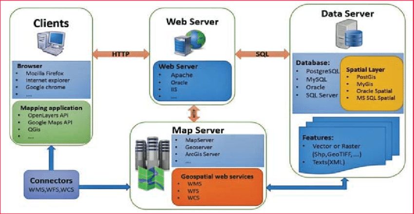
Our company specializes in Web Mapping services, revolutionizing how businesses and organizations visualize and interact with geographical data online. Through cutting-edge Geographic Information Systems (GIS) technology, we create dynamic and interactive maps that provide valuable insights and enhance user experiences. Our web mapping services seamlessly integrate various data layers, from satellite imagery to demographic information, enabling users to overlay and analyze multiple datasets.
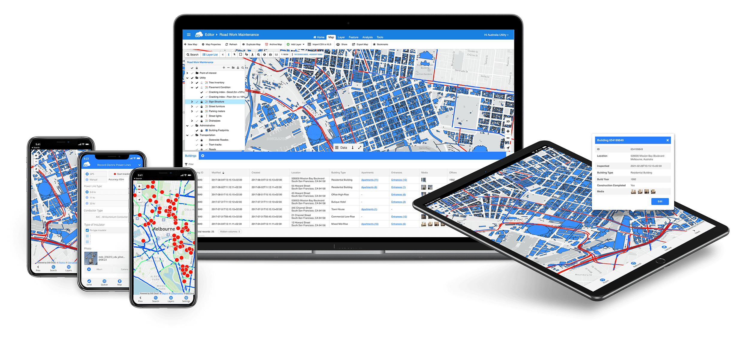
Gistechke Ltd develops user-friendly web mapping platforms that allow users to explore and analyze geographical data in real-time. These platforms facilitate data-driven decision-making and enhance engagement. We prioritize intuitive interfaces that make navigation and data exploration easy for both technical and non-technical users.
Our web mapping services find applications in diverse industries, from urban planning and real estate to environmental monitoring and tourism. By providing real-time access to data and insights, our web mapping solutions empower users to make informed decisions quickly and effectively. Web maps are effective tools for visual communication. Gistechke Ltd’s services enable you to convey complex information in a clear and engaging manner.
Why Choose Us
- We ensure that the maps align with your aesthetics and effectively convey relevant information
- Gistechke Ltd seamlessly integrates diverse data layers, enabling users to overlay and analyze multiple datasets for comprehensive insights.
- Our solutions prioritize user-friendliness, making navigation and data exploration intuitive for both technical and non-technical users.
By choosing Gistechke Ltd’s Web Mapping services, you gain access to dynamic and informative maps that empower data-driven decisions, enhance communication, and provide valuable insights. With our expertise in GIS technology and customization, you can effectively convey complex spatial information and engage users across various sectors.