GistechKE conducts the creation, mapping, enhancement, maintenance, migration and modelling of spatial data. We also conduct statistical analysis, spatial analysis, and other advanced analytic techniques for the design, construction, operation and maintenance of various engineered infrastructures using programming languages, open source and proprietary software. Our experts employ advanced techniques to analyze both traditional and geospatial data, uncovering patterns, trends, and correlations.
Our data analysts extract valuable information from diverse datasets, identifying key metrics and trends. We use statistical tools and techniques to interpret data, providing actionable insights that guide strategic planning and operational improvements.
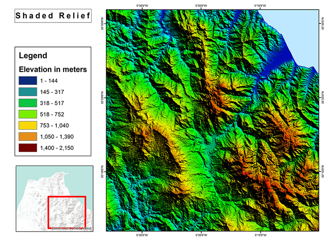
Our spatial analysis experts leverage Geographic Information Systems (GIS) to analyze geospatial data. This involves examining relationships between geographical features, visualizing data on maps, and deriving insights that inform location-based decisions.
Why Choose Us
- We help businesses make evidence-based choices by transforming complex data into understandable insights.
- Our services enable businesses to identify opportunities, mitigate risks, and optimize processes based on both quantitative and spatial information.
- We tailor our analysis services to your specific needs, ensuring that the insights generated are directly applicable to your business objectives.
With Gistechke Ltd’s Data Analysis and Spatial Analysis services, you gain a strategic partner that transforms data into actionable knowledge. Experience the power of informed decision-making, leveraging insights that enhance efficiency, innovation, and success across diverse industries and scenarios.