Embark on a journey with GISTechKE Ltd, where cutting-edge technologies like Google Earth Engine and cloud computing converge to unlock the Earth’s secrets from afar. Through satellite imagery, aerial photography, and advanced sensing techniques, we offer a diverse array of applications and invaluable insights. Harnessing HTML5, OpenLayers, LeafletJS, Geoserver, QGIS, and more, we craft intuitive web maps that bring GIS data to the fingertips of a wider audience.
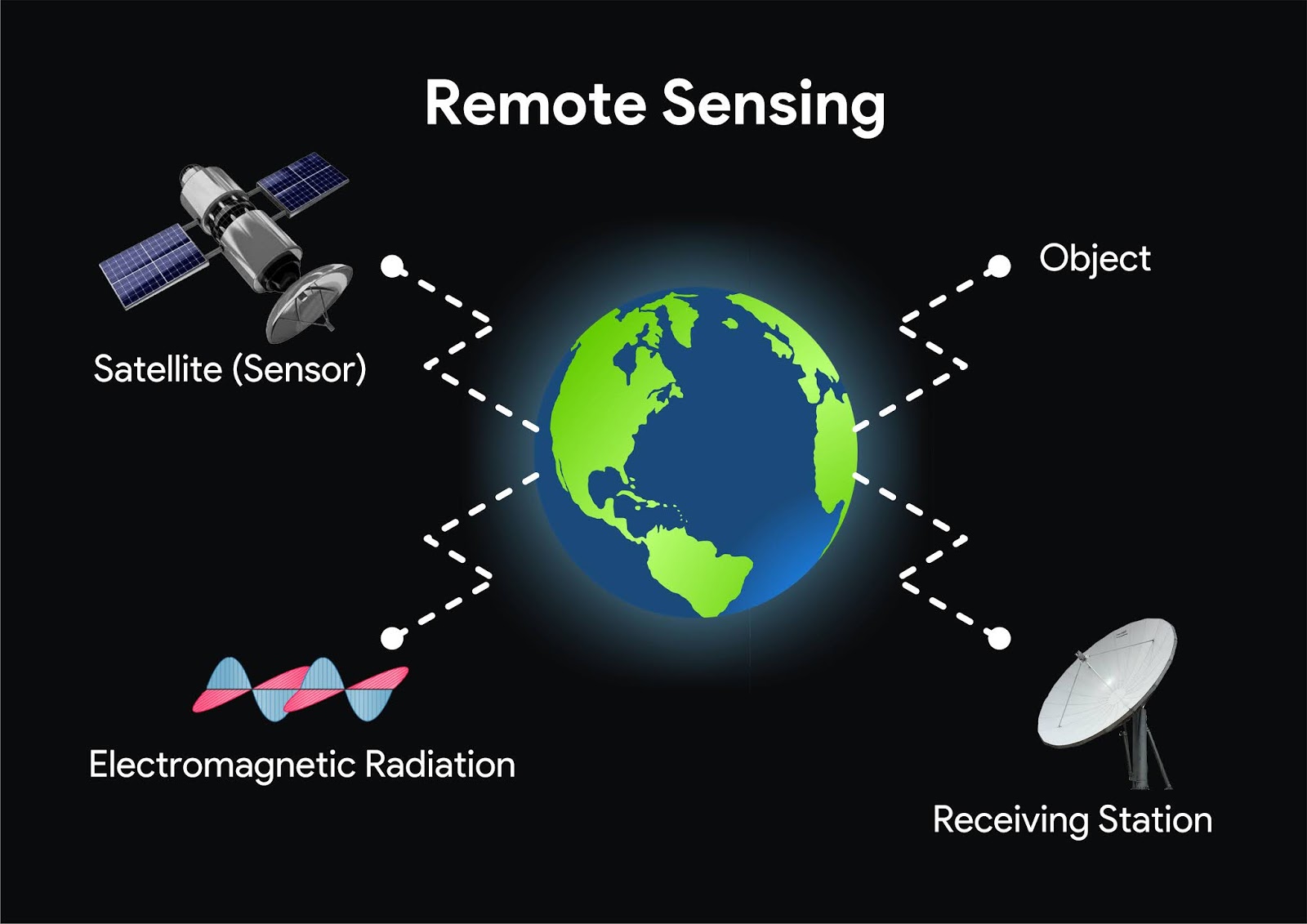
Gistechke Ltd leverages satellite data to capture high-resolution images of the Earth’s surface. These images offer valuable insights into land features, vegetation, urban development, and more. Our remote sensing services include capturing imagery from aircraft or drones, allowing for detailed and localized data collection. We provide crop health analysis, yield predictions, and land use mapping, helping farmers and land managers make informed decisions.
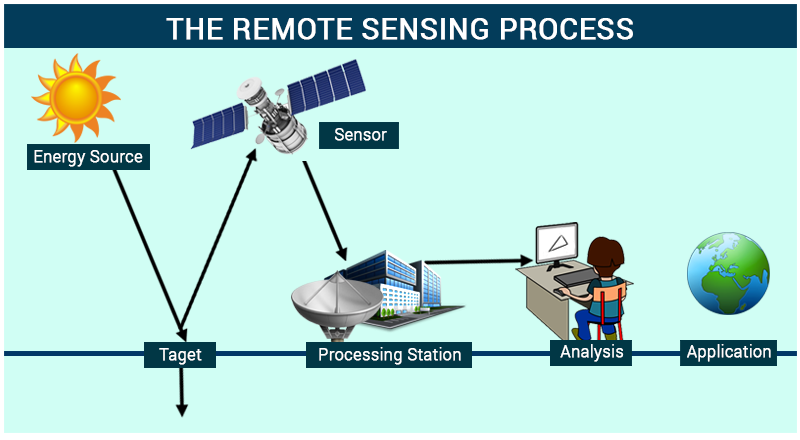
Our services contribute to urban development by analyzing population density, transportation networks, and urban expansion. We not only collect imagery but also analyze and interpret the data to provide actionable insights. Our experts tailors remote sensing solutions to your specific needs, ensuring that the collected data and analysis align with your objectives.
Why Choose Us
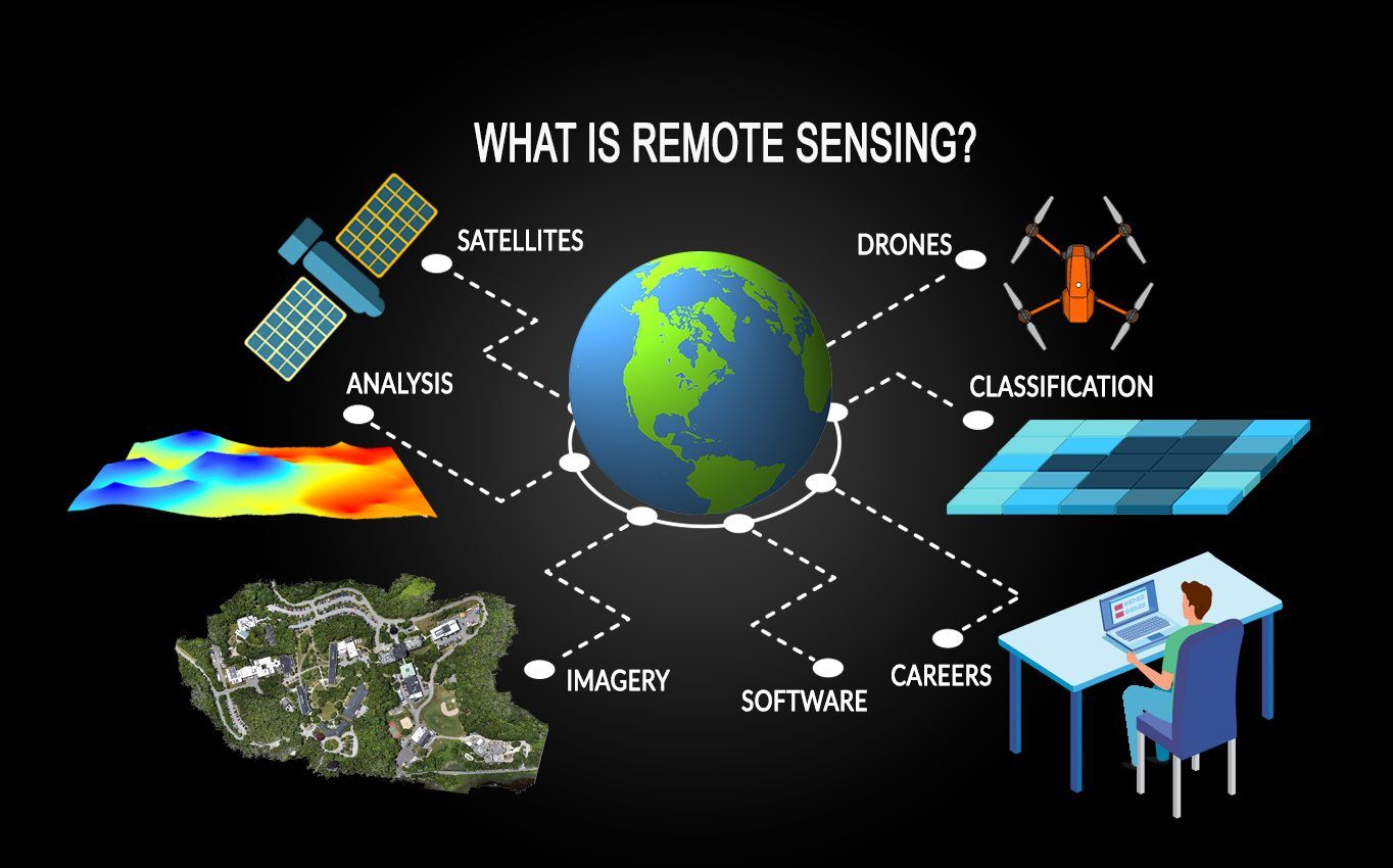
- Our services have a wide range of applications, from environmental monitoring and agriculture to disaster management and urban planning.
- Our insights enable you to make data-driven decisions, optimize operations, and foster growth across diverse industries.
- Gistechke Ltd not only collects data but also provides expert analysis and interpretation.
- Our services have a wide range of applications, from environmental monitoring and agriculture to disaster management and urban planning
With Gistechke Ltd’s Remote Sensing services, you gain access to a wealth of information derived from distant observations. Our solutions empower industries ranging from environmental conservation and agriculture to disaster management and urban planning, enabling informed decisions and strategic growth.