Cloud Computing in Remote Sensing
In the age of cloud computing, satellite imagery analysis has reached unprecedented heights of efficiency and accuracy. This blog explores the dynamic landscape of satellite imagery analysis in the cloud era, presenting a compelling case study and a systematic approach to leveraging cloud tools, models, spatial algorithms, programming languages, and time series data. Discover […]
Read More
Smart Contracts in Precision Agriculture
Integrating Blockchain and GIS for Efficient, Transparent, and Profitable Farming In the dynamic realm of precision agriculture, the fusion of smart contracts and Geographic Information Systems (GIS) emerges as a game-changer. This integration harnesses the secure, automated execution of blockchain contracts with GIS’s geospatial insights, promising unprecedented efficiency, transparency, and profitability for agribusinesses worldwide.
Read More
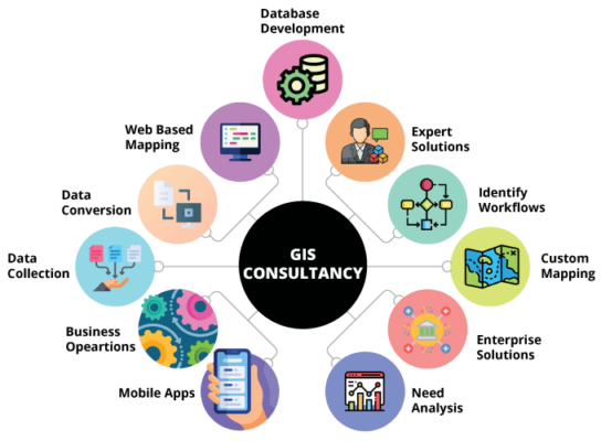
Geospatial Intelligence with GISTechKE Ltd
In a data-driven era, harnessing the power of geospatial intelligence is becoming imperative for organizations seeking a competitive edge. Geospatial intelligence, or GEOINT, is the fusion of geographic information, analytics, and visualizations to solve complex problems. Here’s a comprehensive look at how GISTechKE Ltd, a pioneer in geospatial solutions, can revolutionize your operations.https://geoint.blog/
Read More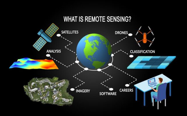
using Remote Sensing in Disaster Management
Leveraging Remote Sensing for Effective Disaster Management In an increasingly interconnected world, the occurrence of natural disasters has become an unfortunate reality. From earthquakes and hurricanes to wildfires and floods, these events can cause widespread devastation, disrupt communities, and put lives at risk. However, advancements in technology have paved the way for innovative approaches […]
Read More